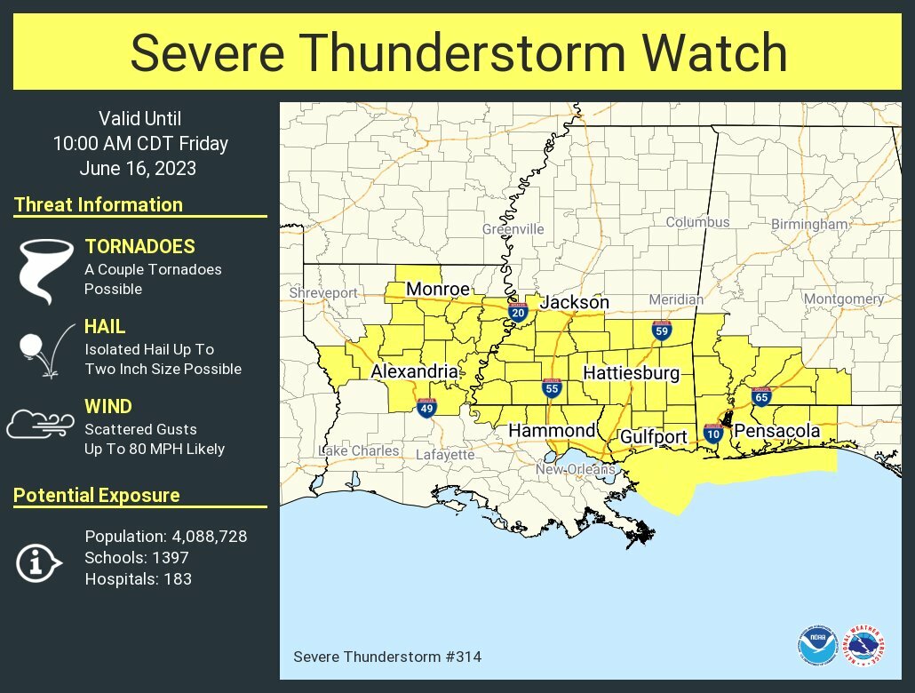
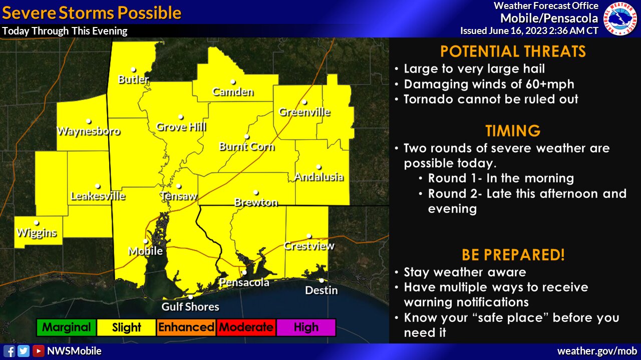
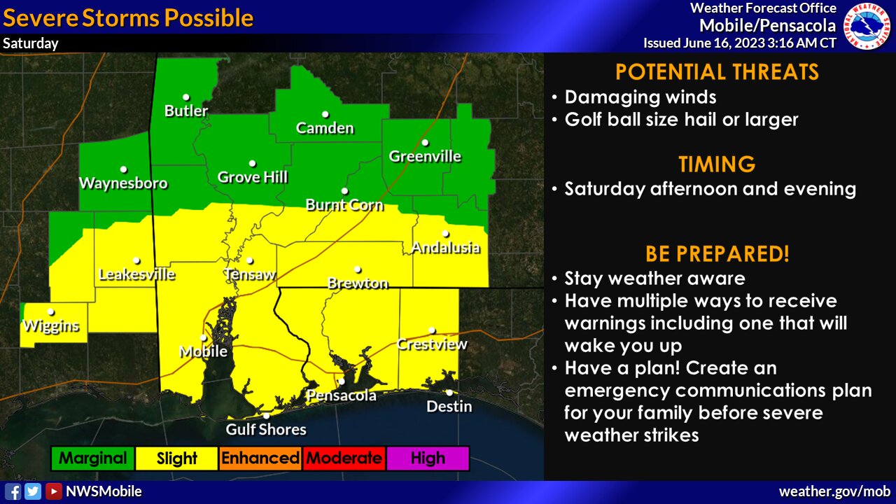
Two more rounds of severe storms and heavy rainfall will occur this morning across Baldwin County, and again late this afternoon through tonight.
According to Baldwin County EMA and the National Weather Service of Mobile, there is a risk for severe storms today. A severe thunderstorm warning has been issued for all but the extreme northeast portion of the warning area until 10 a.m. There is also a flash flood watch in effect for most of the area through this evening.
Severe storms are capable of producing damaging winds of 60+ miles per hour, golf ball size hail or larger, and tornadoes through 11 a.m. and again between 4 p.m. through tonight.
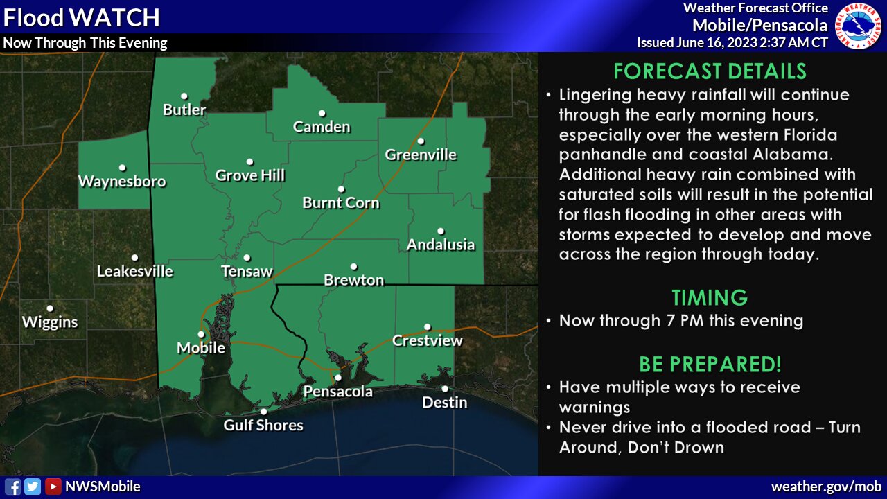
Flash flooding is an associated risk with this forecast, too. Very heavy rainfall will be associated with each cluster of thunderstorms that will develop and move repeatedly over the same areas. A flash flood warning is in effect for most of the forecast area. Rainfall totals of 2 to 4 inches are expected, with localized amounts in excess of 6 inches.
The flash flood watch is in place through tonight for the interior southeast Mississippi, southwest and south-central Alabama and the western Florida Panhandle.
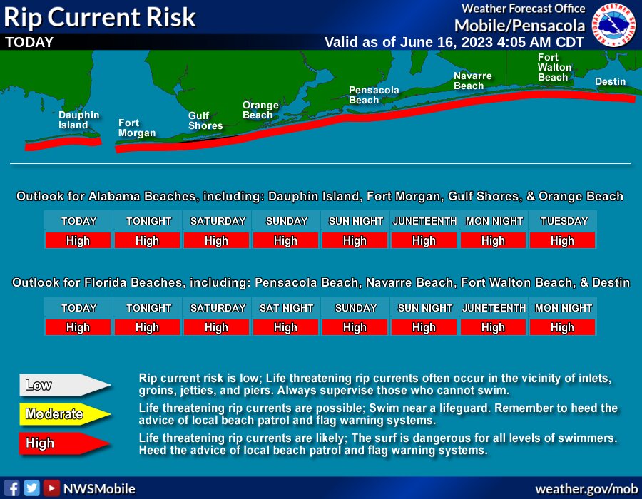
Additionally, there is a high risk of rip currents for all area beaches through early next week.